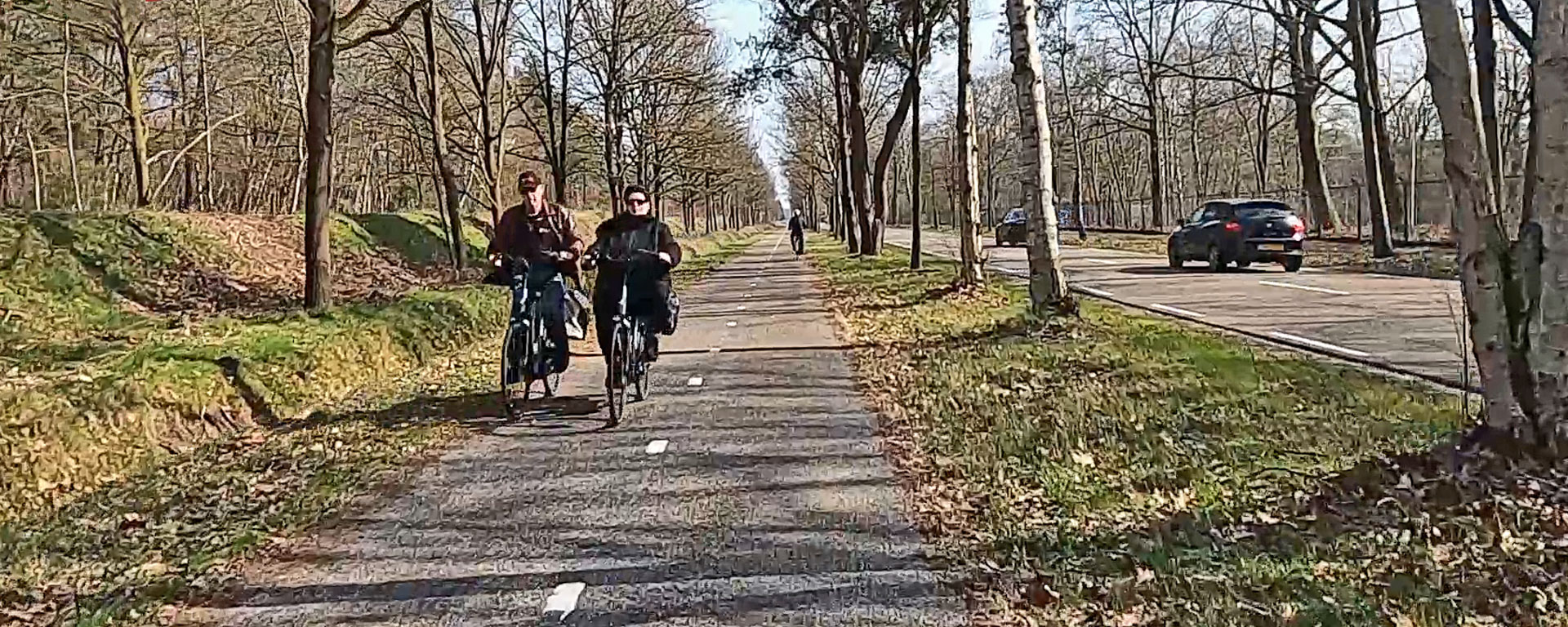
For centuries there was only one safe route to cross the moor and heath between Oirschot and Eindhoven. Nowadays there are other main routes for motor traffic especially. In recent years the old and most direct road has slowly been turned into a so-called Green Corridor; a very pleasant route to walk and cycle between these two places in the Province of Brabant in the South of the Netherlands. The project is not entirely finished yet, but I went there to test it out.
After initial ideas emerged in 2004, a nature conservation society, the heirs to the Philips Family and the city of Eindhoven joined forces to reconstruct the old 14 kilometre long route between Eindhoven and Oirschot. In 2013, that town and municipality joined the team. This meant that the route could and would be developed in a totally different way. Before, it had been the main road. A straight-forward road for motor traffic with separate cycle paths on the shortest route between the market of Oirschot and the city centre of Eindhoven. The vision for the future was different. The road was to become a connection through nature, with respect for the location and mainly for people who decide to use the route on foot and by bicycle. The area could then also be used for recreation. Most of the redevelopment started on the Eindhoven side of the route and when things began to take shape some residents of Oirschot started to become alarmed. Once Eindhoven literally closed most of the route to private motor traffic on their territory it annoyed and worried these Oirschot residents. Protest groups formed. They were objecting against Oirschot planning the same on their part. Some people did not want to be forced to use the motorway route. Because – they said – that route is “longer and has more traffic lights”. They organised an inquiry stating: “when you need to go to hospital in Eindhoven you will have to wait in the traffic jams on the A58 motorway” and: “we haven’t seen a single good reason to close this road”.


While Eindhoven continues to change the route bit by bit it has since been decided that the road will stay open to motor traffic on the Oirschot side. On the Eindhoven side some new connections will be made to make it possible to reach all existing and new destinations including Eindhoven Airport and a new industrial zone in this area. The project to upgrade the accessibility of north-west Eindhoven includes completely new roads and a number of bridges. The recently opened huge cycle bridge to cross the A2 motorway in this area is also part of this project. If you look at it in a negative way you could argue this may have been the hidden agenda of Eindhoven behind the “Green Corridor”, but all the new infrastructure does make it possible to close the old road and redevelop the area around that shortest connection as a green zone, also for recreation.


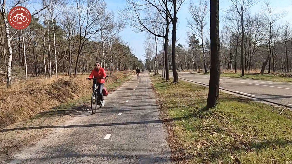
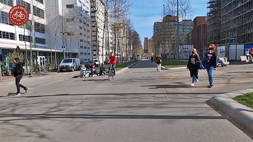
Eindhoven closed the part called Oirschotsedijk between Anthony Fokkerweg and Zwaanstraat to practically all motor traffic in September 2013. When I portrayed Eindhoven as nominee for best cycling city in a post in 2014, the old road had already been transformed into a genuine cycle street with red asphalt. Thousands of new oaks had been planted alongside of the route, together with one million (!) tulips and daffodils. This must look very pretty this time of the year (see my last post). But I filmed my ride too early for the bulb flowers to bloom. (I filmed this on the same day as my post about the reconstruction of the Eindhoven city centre, 24 March 2021.)
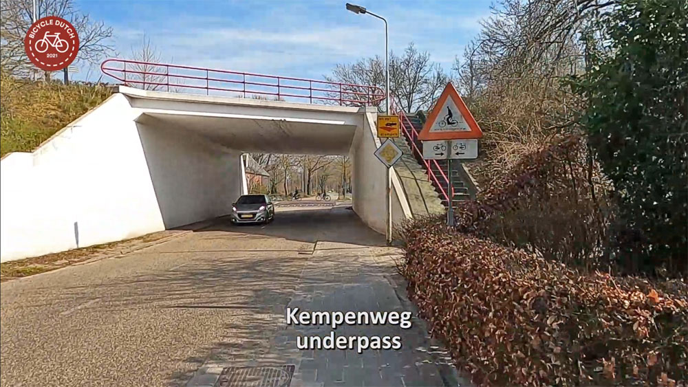
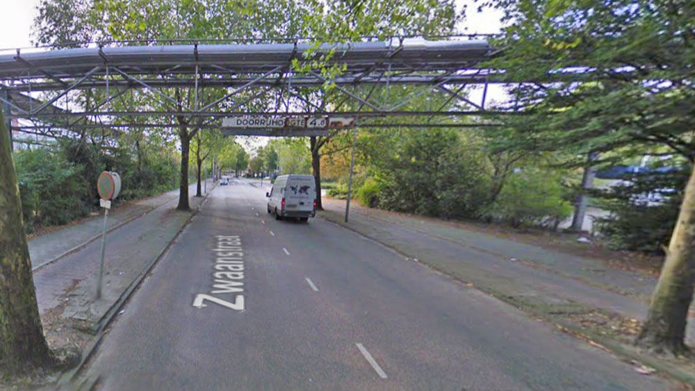
The connecting Zwaanstraat, all the way south to the underpass of Beukenlaan was then also mostly closed to motor traffic and completely reconstructed. That part of the route reopened as a main cycle route in March 2018. Some of the industrial elements in this area (this had been the site of some Philips factory buildings) were saved. This street connects to another former industrial zone of Philips, Strijp S. That industrial heritage area has been redeveloped in the last 20 years as a hub for culture, creative companies and young urban living.

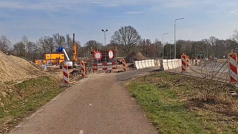
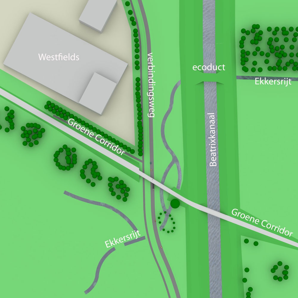
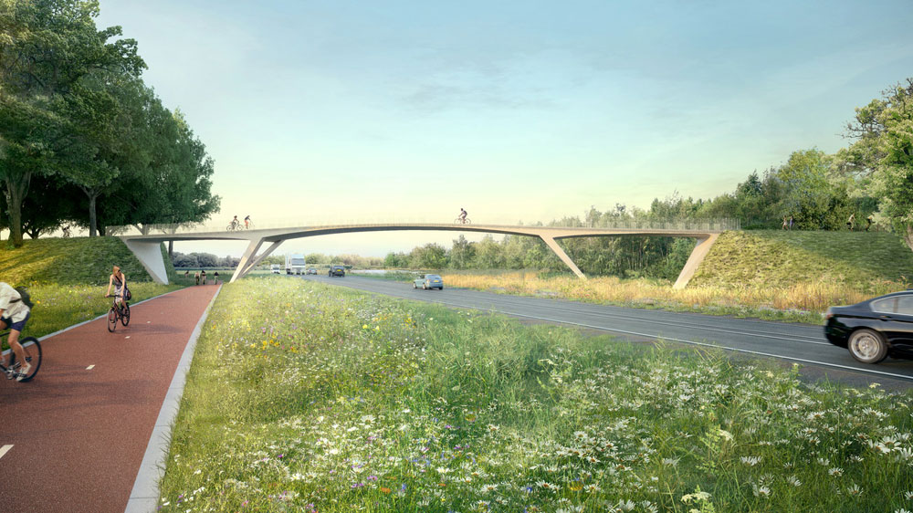
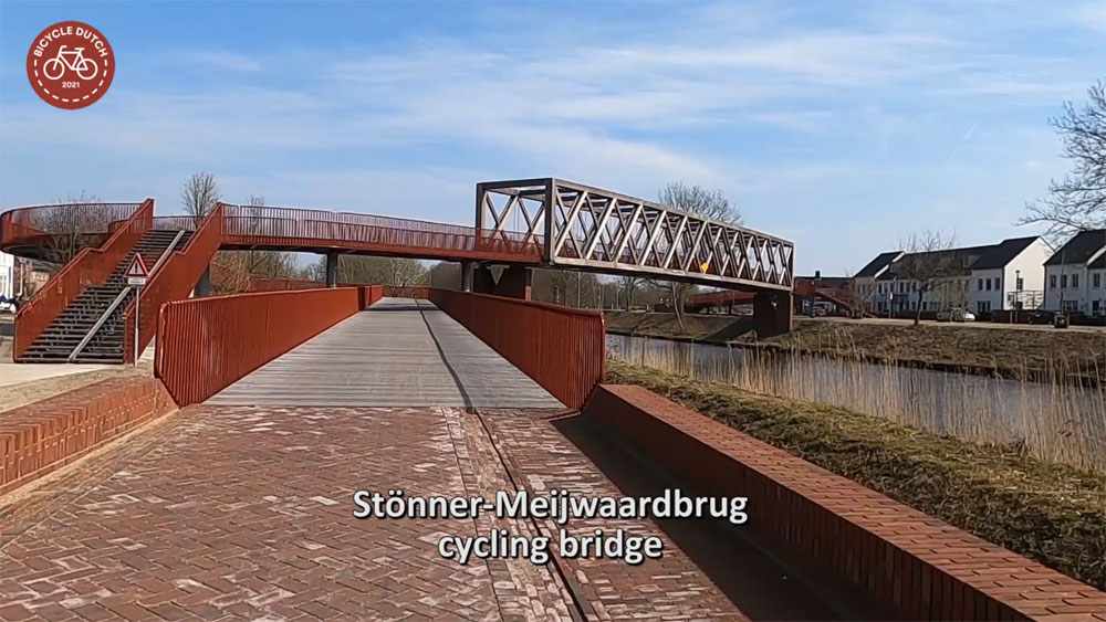
Things do happen in Oirschot too. A direct connection between the Green Corridor and the actual centre of Oirschot was established in 2020, when a beautiful wooden bridge for walking and cycling was opened. This closed the missing link over the Wilhelmina Canal. I showed the new bridge on my blog at the time. Eindhoven is currently constructing a new bridge over the Beatrixkanaal. This bridge for walking and cycling replaces the old bridge that was also for motor traffic. The new bridge includes a crossing over a partly new road to the airport.


The development of the Green Corridor between Eindhoven and Oirschot continues even if the Twitter account and the website have fallen a bit silent. Links to the reports with the visions for their part of the Green Corridor in Eindhoven and Oirschot can be found on the website of the latter. Although the project is not completely finished and parts of the cycling infrastructure in Oirschot really need an update, you can already cycle really well between the two places. You can experience that for yourself through my video.
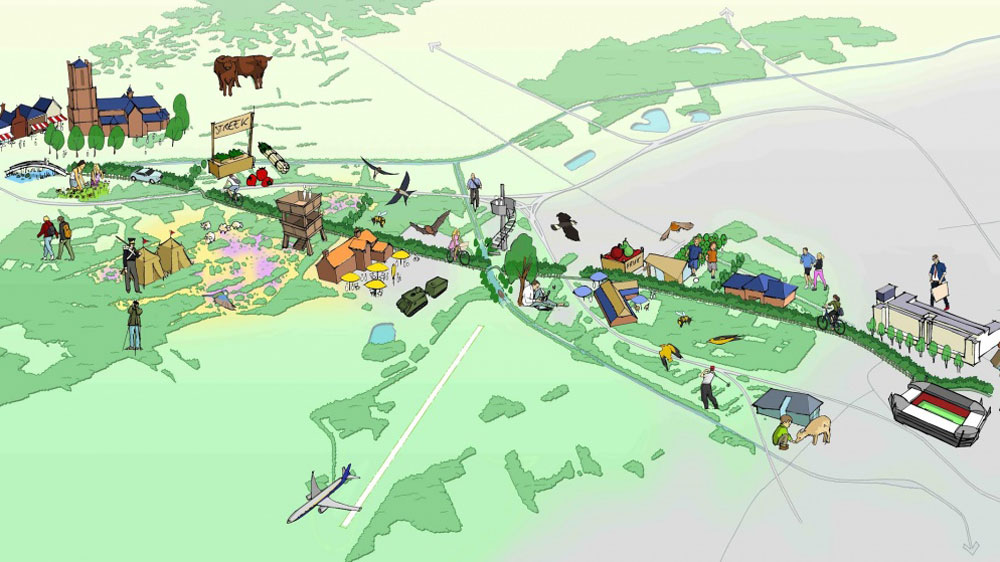
A map of the 14.2km long ride from Oirschot to Eindhoven-Centraal

The whole world should be connect by bicycle paths!
Green corridor is fun for the cyclists. Thank you 😊