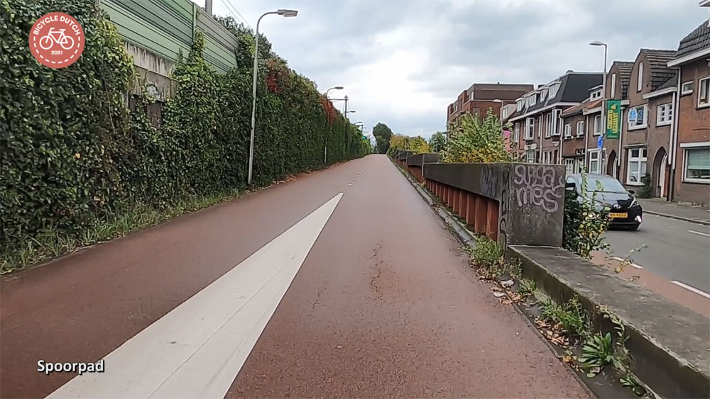
My ride for this week’s post is on a familiar route. I rode from Tilburg to Oisterwijk again, just like I did almost 10 years ago, on a route that was then already decades old. In the previous video, published in January 2012, I started at the station of Tilburg. This time, I started at the entrance of the underground bicycle parking garage in the city centre. Most of the route is still exactly as it was a decade ago, but in Oisterwijk some parts of the surfaces were redone.

I was not able to find an exact date of construction for this route, but it was an extension of the first experimental route in Tilburg which was built in 1976/1977. The first part of the route to Oisterwijk, next to the railway line in Tilburg, was indeed finished in 1977. Some later sources claim the entire route was built in 1976, but that is not true. I found proof of that in an evaluation report from the national government which was written in 1977. Since the national government had paid the entire route in Tilburg, they wanted to evaluate how beneficial it had been. The extensions to Berkel-Enschot and Oisterwijk are mentioned in that report, but they had not been constructed at that time. The decision to build the route to Oisterwijk (and to also finance it 100% by the national government) was taken on 23 March 1977. The route must have been constructed shortly after that decision, so in 1977 or maybe 1978. It makes the route well over 40 years old now.


That first part of the route, in the municipality of Tilburg, had been quite an undertaking. The route runs parallel to the railway but crosses the east circular ring road and a canal. A bridge and a viaduct were designed right next to the dike on which the railway runs, but, as the cross sections from the evaluation show, that dike had to be changed considerably. That made this part one of the most expensive sections of the Tilburg demonstration route at 1.4 million guilders. (Which is comparable to 3.72 million euros today.) The cost for an underpass in the city is not stated in the report, but that must have been very expensive too.


It was nice to compare the state of the route with how it was 10 years ago. Not much changed, but just outside Tilburg the route could do with a sweeping. The fallen autumn leaves made it a bit too narrow. I trust that will be done soon enough. Some real changes were made in the municipality of Oisterwijk. I noticed this right away, because the asphalt was no longer red and there were lines at the edge of the path. That is very modern, so I knew that had to be recent. The stills from the video of the former ride show that this part was indeed resurfaced. At one location the route got a lot greener, but a short distance later a line of trees was removed. Those trees didn’t look old, but it still surprised me they had been removed.


One intersection – with priority for cycling over a rather busy road – is currently under reconstruction in Oisterwijk. The sign to announce the works was already there when I filmed this ride about a month ago.
A local newspaper reports: “Despite earlier adjustments, which have had some effect, the crossing of the cycle route with Baerdijk is still considered to be a dangerous point. This regularly causes problems at the location where busy bicycle traffic and car traffic to and from the centre intersect. Research by our editors has shown that the stop signs are frequently ignored by motorists. ‘Attention signs’, placed a few years ago, had no significant effect.”
A spokesperson for the municipality said: “We want to make this crossing safer by widening the central refuge space, installing clearly different paving materials and a green-colored part for the cycle path.”
Isn’t it interesting that it is always motor traffic and especially the behaviour of drivers that force cycling infrastructure to be adapted? In this case the standard red paving for the cycleway has apparently lost its attention value and so the municipality is now going to try green. Let’s hope that does make a difference. This intersection is indeed the most unpleasant in the entire route! I will have to visit again later, to see how the crossing changed.


All in all, this is still a very nice and quick route as it has been in the past 40 years. I rode the length of the route, 9.2kms, in 26.5 minutes, which is roughly 21 km/h, or much faster than usual. (Especially with my heart condition this was surprising to me too, but I did have a strong wind in my back).
Enjoy the ride!


Mooi overzicht van wat ooit een uniek gebeuren was! We gaan er morgen of overmorgen aandacht aan geven op Oisterwijknieuws.nl
Once again a successful video. I watch almost all the videos, the quality is very very good. Are you still filming with the GoPro 8 or 9? Or have you bought another camera in the meantime?
Thanks. This was filmed with the GoPro8.
Thanks alot and regards, Klaus
Another fine video, thanks Mark. Inspirational as always.
So relaxing to watch smooth progress with almost no stops.
Maybe one day we will have 1/4 as good infrastructure in UK, if our planners could learn from the Dutch.