
With the obligation to stay home as much as possible and the urgent advice to only use public transport for important jobs I am not able or allowed to use the train to go somewhere to film for this blog. The last trip I made in a train was over a month ago to film in Utrecht. Fortunately, the surroundings of my hometown ’s-Hertogenbosch are beautiful. I am able to reach several nature reserves at a relatively short distance by bicycle. Since the Dutch are encouraged to go out to cycle (while adhering to the social distancing rules) I was able to film my Wednesday rides to three of those areas. In the coming weeks I will show you those examples, starting in this post.


For this week’s video I cycled to a nature reserve south-east of Oss. As you may remember there is a fast cycle route from ’s-Hertogenbosch to Oss, the F59 that I showed you earlier. You might expect I used that route but I didn’t. That route was specifically designed to connect the many villages between ’s-Hertogenbosch and Oss. Most people will use only part of the route from one of those residential areas to reach either ’s-Hertogenbosch or Oss. It is therefore not the fastest route when you really have to cycle between those places as I now had to. That is why I choose a route directly parallel to the motorway A59 which, with 25.7km, is almost 2 kilometres shorter than taking the F59 route.


The landscape here in Brabant differs much from the part of the Netherlands that is called Holland with its fertile wet meadows below sea level. The province of North-Brabant is above sea level with a sandy soil that is very poor in nutrients. Most of the current forests here were the result of afforestation in the 19th century. South-east of Oss we find the Nature Reserve Herperduin with 400 hectares of beautiful forests, ponds and remnants of sand-drifts, that give you an idea of how this part of the Netherlands looked when most of it was still a primeval forest. Until recently Herperduin was a separate nature reserve but it has become part of a far larger nature reserve called Maashorst. This was achieved by connecting the two with two wildlife bridges to cross a motorway and a larger road. Those wildlife bridges were opened in 2013 for smaller animals like European badgers, but they have only been opened up for larger animals late 2019. The newly formed total nature reserve is now 2,400 hectares in size. You can find three imposing grazers that roam freely to help ensure that the natural landscape is as it once was: wild, pure and authentic. In the part where I cycled you can only find the Exmoor pony but in other areas you can stand eye to eye with the tauros and even the European bison!


The entire area of the Maashorst is fenced off and can only be entered via cattle-grids to prevent those larger animals from leaving the nature reserve. Cycling in these forests does mean you can come close to an enormous bull. That doesn’t always end well, but usually humans are to blame when it does go wrong. I cycled in the park following the signs to the numbered junctions, the nationwide network for recreational cycling.
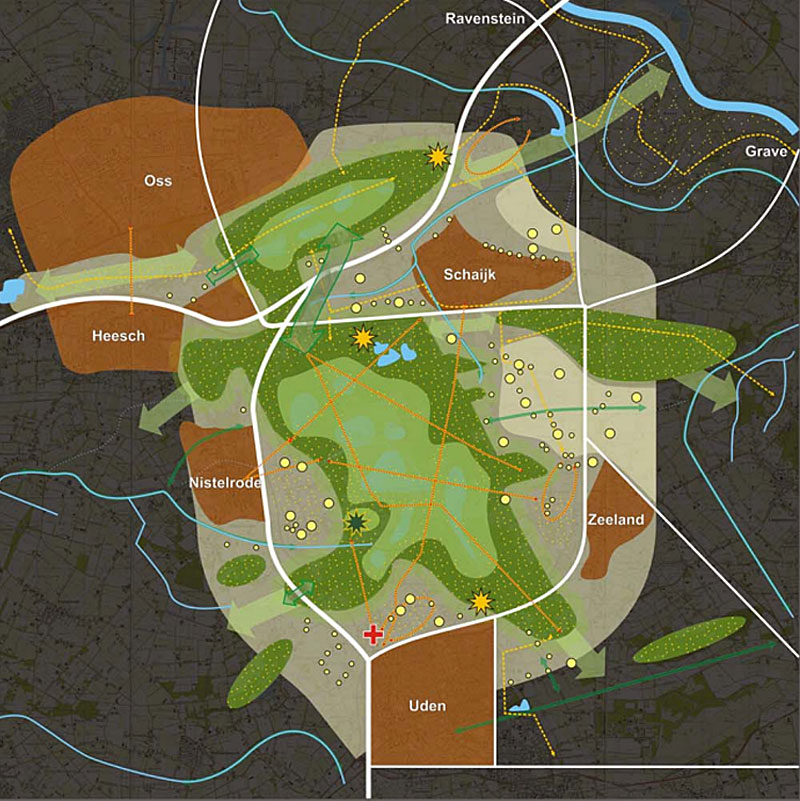

With these programs for reintroducing large wild animals in the Netherlands the authorities want to return some of the original rugged nature at carefully selected locations. The Maashorst is a very special place, a nature reserve aspiring to become a national park (for which they make beautiful promotional videos!). Apart from all the beautiful nature archaeologists found royal graves from the early Iron Age, a cemetery from the late prehistory, the largest bronze depot in the Netherlands from Roman times and a number of forgotten villages from the Middle Ages. I am very lucky to have such a beautiful place at cycling distance from my home. Enjoy the videos.


360° version from intersection 17 to 23
ordinary version (5:20 longer) all the way to intersection 35
Excerpts of the ride to and from the nature reserve
My entire route in Google Maps. The orange bit is in the continuous video.
Excerpts of the rest of the ride can be seen in the third video.
I took the shortest route on my way to the Maashorst, but I took a more
scenic route on the way back. Until Geffen from where I took the most direct route again.

Looks like nice places in that nature reserve. I’m glad you are still getting out and about. I think staying home without interaction and fresh air is very unhealthy.
I’m using my bike in Australia much more in recent years and accumulated thousands of kilometres on an app before I deleted it due to new surveillance laws this month. Nevertheless, I still use the bike and have noticed the sudden increase of bike users enjoying the fresh air during the economic shutdown.
Dear Mark, on such a narrow bicycle path it is impossible to keep to the 1.5 m distance rule, and regarding Corona transmission, speed is no alternative for distance. Not so clever a choice for your ride this time…